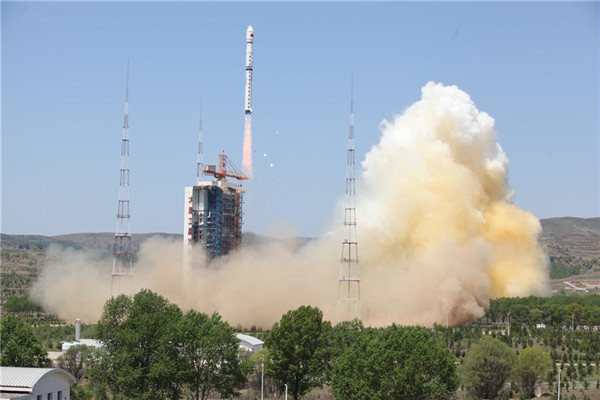
A Long March 4B rocket carrying a new civilian high-resolution mapping satellite “Ziyuan III 02” and two NewSat satellites from Uruguay blasts off at the Taiyuan Satellite Launch Center in Taiyuan, capital of north China’s Shanxi province, May 30, 2016. All three satellites have entered preset orbits, the Taiyuan center said in a statement. [Photo/Xinhua]
BEIJING — China launched a new civilian high-resolution mapping satellite on May 30 from the Taiyuan Satellite Launch Center in northern Shanxi province.
The Ziyuan III 02 satellite took off on the back of a Long March 4B rocket at 11:17 am Beijing time, according to the center. It was the 228th flight mission by a Long March carrier rocket.
Also on board the rocket were two NewSat satellites developed by URUGUS S.A., the Uruguayan subsidiary of Argentine company Satellogic.
All three satellites have entered preset orbits, the Taiyuan center said in a statement.
Ziyuan III 02 will be used in land resources surveys, natural disaster prevention, agricultural development, water resources management and urban planning, among other tasks. It is the second satellite in a remote-sensing mapping system China plans to build by 2030.
It will join its predecessor Ziyuan III 01, launched in January 2012, to form a network and capture high-definition, 3-D images and multispectral data.
Earlier reports said another stereo mapping satellite, Gaofen-7, is expected to be launched in 2018.